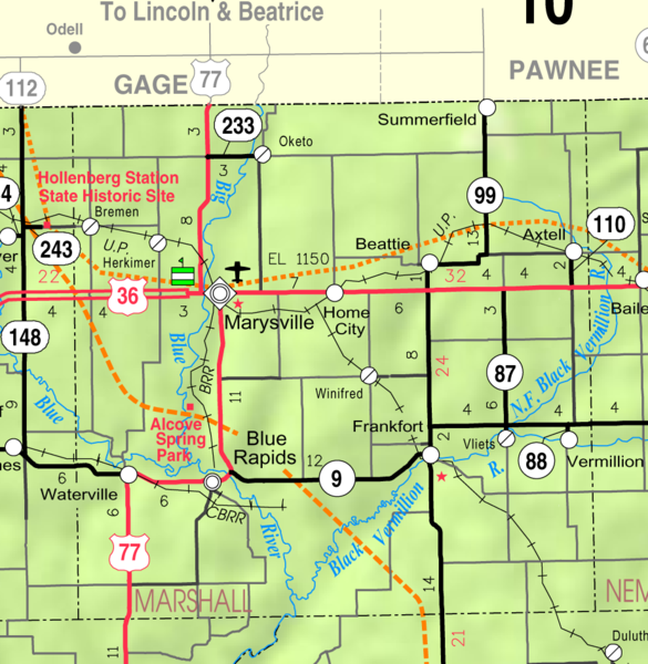
Marshall County is in the first tier of counties south of Nebraska, and the fourth, west of the Missouri River. It is bounded on the north by Gage and Pawnee Counties (Nebraska); on the east by Nemaha County; on the south by Pottawatomie and Riley Counties; and on the west by Washington County.
Geological formations in Marshall County are most apparent in the hills and bluffs along the Big and Little Blue Rivers, that divide the uplands from the river valleys. These hills and bluffs are filled with an endless variety of building stone, the finest among which is the magnesia limestone, which can be readily modeled into any shape by sawing or cutting, and is susceptible to receiving a fine, smooth polish; The Marshall County limestone is of superior quality, quarrying in massive blocks, and is almost entirely free from petrifications.
County Seat: Marysville, Kansas
Date organized: August 25, 1855
County History:
Cutler's History of the State of Kansas, Marshall County
Historic Landmarks, State, National:
County Historical Society:
Marshal County Historical Society on Facebook
Websites about the county:
- Marshall County Government
- City of Marysville, Kansas
- City of Blue Rapids, Kansas
- City of Waterville, Kansas
- City of Frankfort, Kansas

