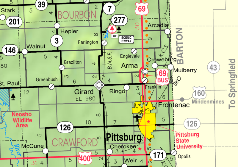
Crawford County lies in the eastern tier, and in the second tier from the southern boundary of the State. It is bounded on the north by Bourbon county, on the east by Missouri, on the south by Cherokee County, and on the west by Labette and Neosho Counties.
The boundaries of the county were defined by an act of the Legislature, approved February 13, 1867, in the following language: "That the territory included within the following boundaries shall constitute the county of Crawford, to wit: Commencing at the southeast corner of the county of Bourbon, thence run south on the east line of the State of Kansas to the southeast corner of Section 13, Township 31, Range 25; thence west to the east line of Neosho County as defined in an act approved February 26, 1866; thence north to the southwest corner of Bourbon County; thence east to the place of beginning." As thus defined the county is twenty-three miles from north to south, and nearly twenty-six miles from east to west, containing 592 square miles, or 578,880 acres. Source: Cutler's History of the State of Kansas
County Seat: Girard, Kansas
Date organized:1867
County History:
- Cutler's History of the State of Kansas, Crawford County
- Crawford County History
- History of Girard, Kansas
Historic Landmarks, State, National:
- Neosho Wildlife Area
- Old Fox theater in Pittsburg, KS
- Pittsburg Public Library in Pittsburg, Kansas
- Crawford State Park
- Franklin - Arma Sidewalk
County Historical Society:
Websites about the county:
- Crawford County, Kansas Government
- City of Girard, Kansas
- Crawford County information
- City of Pittsburg, Kansas

