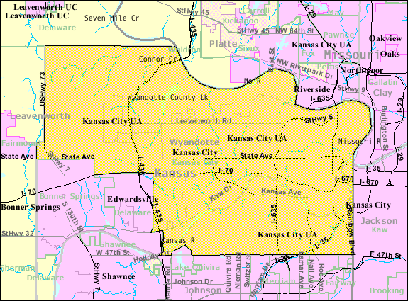
Wyandotte county, the smallest in the State, lies mainly between Kansas and Missouri Rivers, as they approach each other to make a juncture at the city of Wyandotte. With the exception of Shawnee Township which lies south of the Kaw River the county is in the general shape of a triangle. It is bounded west and north by Leavenworth County northeast to the south by the Missouri River. and southeast by the Kansas River Johnson County lies to the south of Shawnee Township. Wyandotte County contains an area of but 153 square miles.
County Seat: Kansas City, Kansas
Date organized:1859
County History:
- Cutler's History of the State of Kansas, Wyandotte County
- Wyandotte County on Wikipedia
- History of Bonner Springs, Kansas
Historic Landmarks, State, National:
- National and State Register of Historic Places
- Soldiers and Sailors Memorial Building
- Huron Indian Cemetery
- Saucer Castle
- The Rosedale World War I Memorial Arch
County Historical Society:
- Wyandotte County Historical Society
- Wyandotte Historical Museum (Bonner Springs) | Facebook
Websites about the county:
- Wyandotte County Government and Kansas City, Kansas (City and County are Unified)
- City of Bonner Springs, Kansas
- City of Edwardsville, Kansas
- City of Lake Quivira, Kansas | Facebook
- City of De Soto, Kansas | Facebook
Wyandotte County History Timeline
April. 1837 — Rev. John G. Pratt, of Hingham, Mass., located sixteen miles west of Wyandotte (Kansas City, Kansas today) establishes a Baptist mission among the Delawares. He publishes several hymn books in their language.

